A slow-moving weather system meandering its way over the central Gulf Coast is pulling in warm, moist air from the Gulf of Mexico into the Southeastern United States.
This setup is expected to fuel intense downpours of widespread showers and thunderstorms from Alabama to the Carolinas and up through Virginia and West Virginia up to Wednesday morning.
The National Weather Service said those areas were under a slight risk (Level 2 out of four possible tiers) that excessive rainfall would lead to flash flooding through Wednesday.
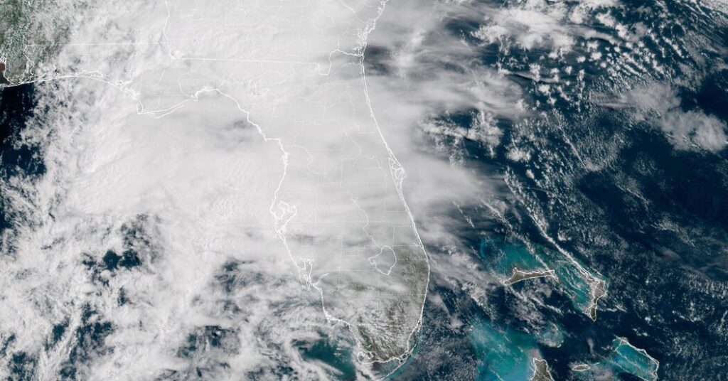
A broader area under a marginal Level 1 risk includes parts of the Tennessee Valley, Central Florida and the southern Appalachian foothills.
“These slow-moving systems bring a lot of moisture up,” said Bryan Jackson, a meteorologist at the Weather Prediction Center. “They’re not moving much, so they tend to bring repeating rainfall to some of the same areas.”
On Sunday, the heaviest rainfall is expected over northern Florida and southern Georgia, where rainfall rates between two and three inches per hour are expected.
With the ground already saturated from recent storms, flash flooding remains a risk.
Flooding is also a concern for parts of Alabama, northern Mississippi and the Carolinas.
Flood watches are in effect over central Alabama and southwestern Georgia to the Florida Panhandle through Monday afternoon. The Tallahassee, Fla., office of the Weather Service warned of widespread rainfall totals between two and six inches, with localized amounts of 10 inches or more possible.
The system is forecast to shift gradually north on Monday, moving into the Tennessee Valley. More rounds of rain and thunderstorms will affect the Southeast into parts of the Mid-Atlantic.
The Weather Prediction Center said that rainfall could be especially intense along the Southeast coast and in the mountainous regions. Urban areas along the coast of Virginia were also included in their flood outlook as they are especially prone to flooding during periods of heavy rain.
“We’re looking at a focus along the Blue Ridge, so that’s the eastern side of the Appalachians,” said Mr. Jackson. “Also, along the Carolina coast, up from Myrtle Beach and eastern North Carolina is another focused area for some significant rainfall.”
Some forecasters expressed concern that portions of North Carolina and South Carolina could receive their highest rainfall.
The Raleigh, N.C., office of the Weather Service said it expected two to four inches of rain through Tuesday night, with local amounts up to five inches possible. Forecasters said the heaviest rainfall was expected on Monday and Tuesday.
As the system continues its slow progression, the risk of flash flooding remains for parts of the Mid-Atlantic on Tuesday. Additional rounds of heavy rain are expected, especially in Virginia and northern North Carolina.
The Weather Service noted that the current Level 2 risk of flash floods for portions of the Mid-Atlantic may be upgraded to Level 3 (out of four tiers) early this week, depending on how the forecast evolves.